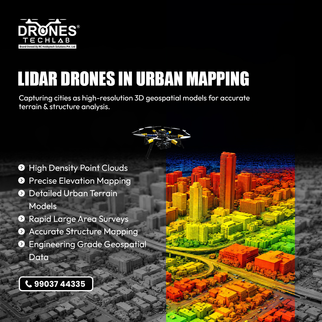
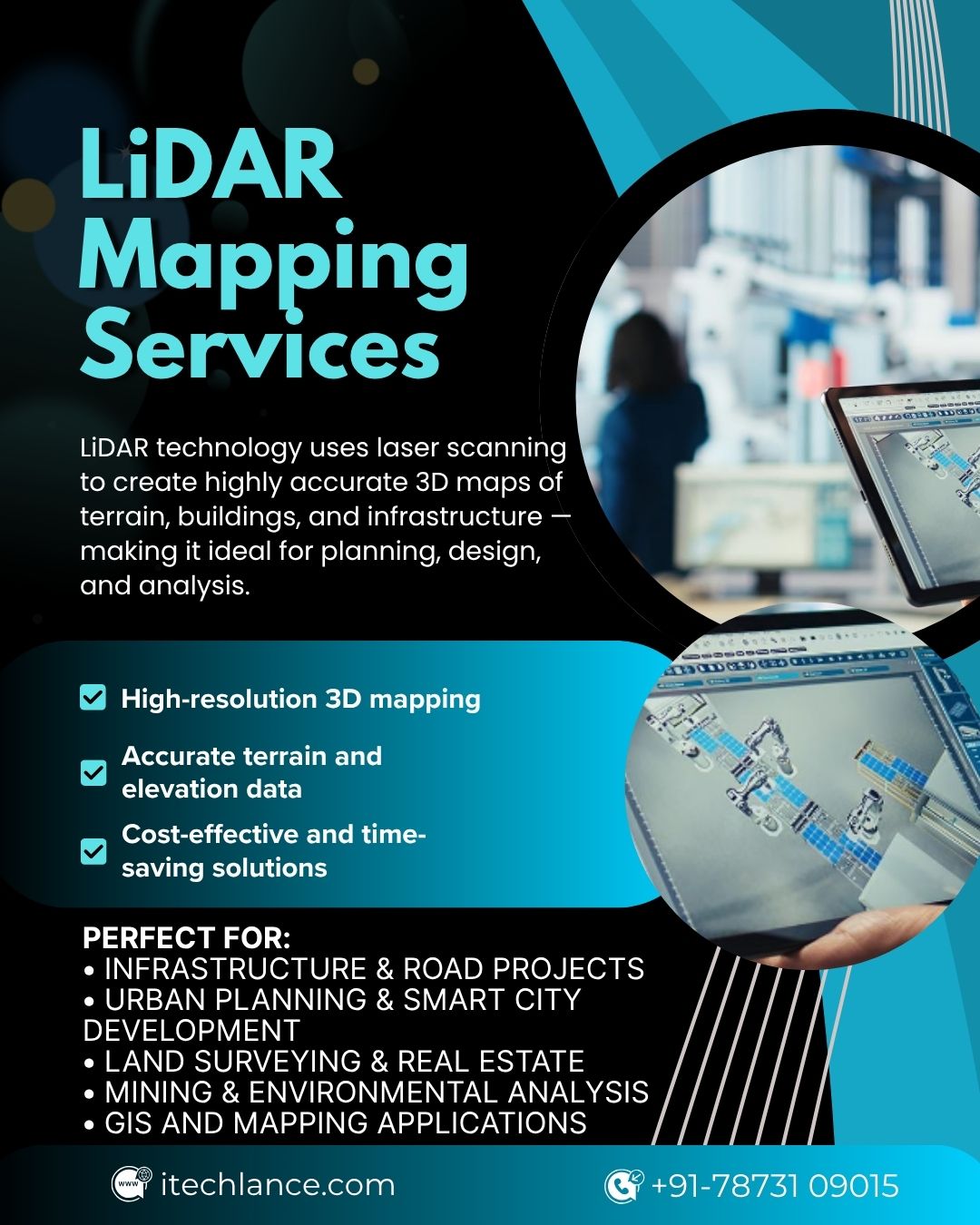
Drones Tech Lab
Drones Tech Lab @Drones_Tech_Lab ·
Urban landscapes are constantly evolving. LiDAR equipped drones capture terrain, buildings, and surface features as dense point cloud data, transforming cities into high resolution 3D geospatial models for smarter planning and analysis. 📲 Contact: 99037 44335 #LiDARMappingN
7
Arshad Mughal
Arshad Mughal @dronerater ·
Lidar Drone Cost in 2025: Full Price Guide & ROI Analysis dronerater.com/lidar-drone-co… Guide to 2025 Lidar drone costs: compare $28,000 entry-level to $200,000+ elite systems, analyse TCO, and maximise ROI. #lidar #lidarmapping #lidarscanning #LidarTechnology #LiDARTech #LidarDrone
Lidar Drone Cost In 2026: Full Price Guide & ROI Analysis

Guide to 2026 Lidar drone costs: compare $28,000 entry-level to $200,000+ elite systems, analyze TCO, and maximize ROI.

From dronerater.com
18
神戸清光
神戸清光 @kobeseiko ·
Zenmuse L3は、高密度LiDARとデュアルRGBカメラでダムの完全な3Dスキャンをキャプチャし、より安全で正確なインフラ点検をサポートします。 #djienterprise #zenmusel3 #lidarmapping
DJI Enterprise DJI Enterprise @DJIEnterprise ·
Zenmuse L3 captures a full 3D scan of a dam with high-density LiDAR and dual RGB cameras, supporting safer, more accurate infrastructure inspections. 🎬 Video credit: Geomesure #djienterprise #zenmusel3 #lidarmappinga
204