Home Explore Settings

Search

SISTEMA DE MAPEO DE CELDAS - SIMACEL
SISTEMA DE MAPEO DE CELDAS - SIMACEL @SIMACELSystem · 4d
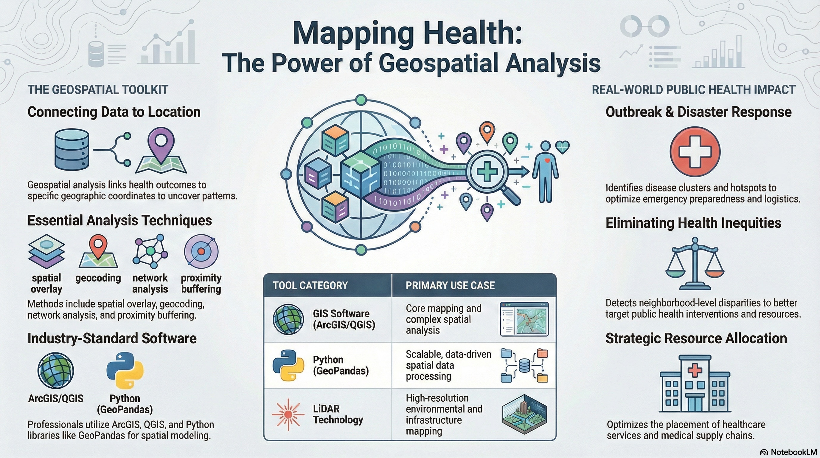
El análisis de telecomunicaciones no se limita a registros temporales. Incorporar una dimensión geoespacial permite interpretar cobertura, alcance y relación entre eventos dentro de un contexto técnico. #TelecomAnalytics #GeospatialAnalysis
1
6
George Zirra
George Zirra @georgezirra · 5d
Replying to @georgezirra
Data: @FAO · @WFP · @WorldBank · USDA · UN Comtrade · UNCTAD Analysis: George Vahyella Zirra — Geospatial Analyst #FoodSecurity #FoodCrisis #GeospatialAnalysis #Nigeria #IranConflict
5
George Zirra
George Zirra @georgezirra · 5d
12 countries are in critical food crisis territory. One strait. One planting season. Interesting weeks ahead. 🧵 Thread: #FoodSecurity #FoodCrisis #GeospatialAnalysis
1
6
Paul Lopez
Paul Lopez @lopezunwired · Mar 16
Purdue University democratizes geospatial data through AWS Open Data Sponsorship Program dlvr.it/TRWk43 #Purdue #GeospatialAnalysis #Technology #Purdue
12
Md Mijanur Rahman🛰️🗺️🛰️
Md Mijanur Rahman🛰️🗺️🛰️ @GISRSStudyHacks · Mar 9
Google Earth Engine Tutorial: Filter and Show Country Boundary in Google Earth Engine. Tutorial Link: youtu.be/vn_aVaiTm0Y?si… Registration link: studyhacksgeospatial.com/product/google… #googleearthengine #GIS #GeospatialAnalysis #geospatialdata #remotesensing #EarthEngine #GEOINT
5
15
519
NJD Web
NJD Web @njdwebs · Mar 2
Cloud-Based Remote Sensing with Google Earth Engine: Fundamentals and Applications is a practical guide to satellite data analysis using cloud computing. #RemoteSensing #GoogleEarthEngine #GeospatialAnalysis #GIS #DataScience #EarthObservation #EnvironmentalScience #ReadOnline
26
Earth MDPI
Earth MDPI @Earth_MDPI · Feb 20
Is Zagreb Green Enough? Influence of Urban Green Spaces on Mitigation of Urban Heat Island: A Satellite-Based Study 🧑‍💼 by Goran Krsnik 🖇️ Read the full Articlmdpi.com/2673-4834/5/4/…F4r #UrbanClimate #GeospatialAnalysis #ThermalGraphs #ClimateRegulation #Zagreb #Mitigatid64
1
2
21
Nikhil Rawat
Nikhil Rawat @NikhilRawat2k3 · Feb 19
Replying to @NikhilRawat2k3
📊 Power BI Dashboard • District-level crime patterns • High-frequency hotspots • Time-based trends Key takeaway: Data preparation > Visualization effort in real-world analytics. Still learning. Feedback welcome �� #DataAnalyst #GeospatialAnalysis #AnalyticsProjec9u
5
BJANALYTICS
BJANALYTICS @BJANALYTICS · Feb 11
How Geospatial Analysis Transforms Public Health Decision-Making youtu.be/uT3lVCoi7KQ?si… via @YouTube 🎧Listen to the audio version here:podcasts.apple.com/us/podcast/dat…l #geospatialtech #geospatialanalysis #publichealth #datascience #arcgis #python #healthcare #cdc #who7
1
24
Load more

Trends

1 · Trending
#ENGENES_MADE_ENHYPEN_7
Trending worldwide
2 · Trending
#ด้วงกับเธอEP9
Only on X · Trending
3 · Trending
DUANG WITH YOU EP9
Only on X · Trending
4 · Trending
エバヤン
Trending worldwide
5 · Trending
フォーエバーヤング
Sports · Trending
Horizon Web