The Sea That Disappeared I
#AralSea #Complexity #Discontinuity #Bureaucracy
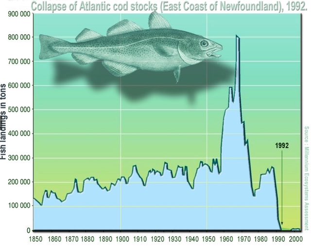
The last post described the collapse of the Grand Banks cod fishery as a paradigm case of linguistic-bureaucratic reasoning failing at a nonlinear threshold. A management system that could only hear nnage, modelled stock estimates, regression curves — remained deaf to the embodied, sensory knowledge of the fishermen who knew, from the feel of the nets and the behaviour of the remaining fish, that something fundamental was breaking. The cod collapsed in 1992. The discontinuity, when it arrived, was total.
The Aral Sea is the same failure mode, at a larger scale and with a more precise and more damning detail.
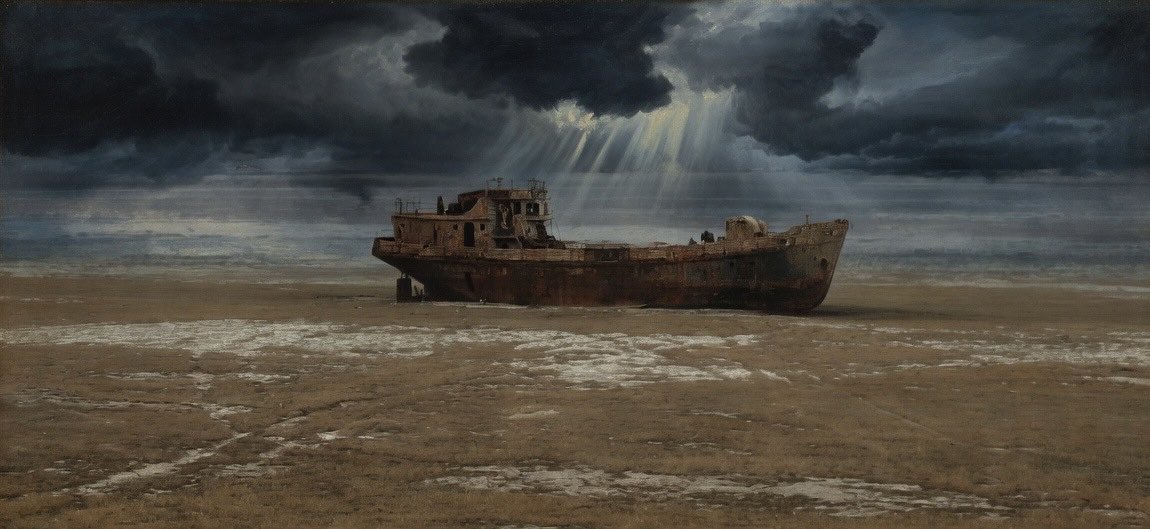
Until the 1960s the Aral Sea was the fourth largest lake in the world — 68,000 square kilometres of water on the border of Kazakhstan and Uzbekistan, sustaining one of the most productive inland fisheries on the planet, moderating the regional climate, and providing the hydrological foundation for the communities and agriculture of the surrounding basin. The Soviet Union, pursuing cotton monoculture as a geopolitical export strategy, diverted the two rivers that fed it — the Amu Darya and the Syr Darya — into a vast network of irrigation canals crossing the Central Asian desert. The lake began to shrink.
What makes the Aral Sea case formally different from the cod fishery — and more instructive for the argument of this thread — is a single documented fact. Soviet scientists knew the sea would shrink. They had models. Those models predicted declining water levels. What the models did not contain was any representation of what would happen at the threshold: the self-reinforcing hydrological collapse, in which shrinkage increases salinity, which kills aquatic life, which reduces evapotranspiration, which reduces local precipitation, which accelerates shrinkage. The scientists believed a hard crust would form over the exposed seabed and minimise the fallout. They were reasoning linearly about a system with nonlinear feedback.
By 2007 the lake had declined to ten percent of its original size. Its salinity had increased from 10 grams per litre to over 100 grams per litre in the southern basin — saltier than the ocean, approaching the Dead Sea. The fishing industry collapsed entirely. The exposed seabed — now called the Aralkum Desert — generates dust storms carrying agricultural chemicals across Central Asia, contaminating glaciers that supply fresh water to over a billion people. Winter temperatures in the region became colder, summer temperatures hotter. Infant mortality in the surrounding communities reached levels comparable to sub-Saharan Africa. Between 100,000 and 700,000 people were displaced. What had been a thriving inland sea is, in the south, effectively gone.
In the formal language of this series, the Aral Sea is a non-linear system that the management system treated as a smooth, linearly-extrapolable process. The water balance — inflow minus evaporation, governed by the coupled dynamics of hydrology, salinity, ecology, and climate — is a system with genuine discontinuities. Once the threshold was crossed, the dynamics became self-reinforcing. The entropy-correct solution was a collapsed sea. The linear model predicted a smaller sea. These are not the same thing, and no amount of additional data fed into a linear model will convert one into the other.