Ellen Brock
Ellen Brock @ellenarun ·
#30DayMapChallenge - day 12 - Map from 2125 - This map will hopefully will NOT be made in the year 2125. This map is based on actual projections (worse case scenario) from IPCC AR6 Sea Level Projections. Python/#xarray
3
364
Kitware
Kitware @Kitware ·
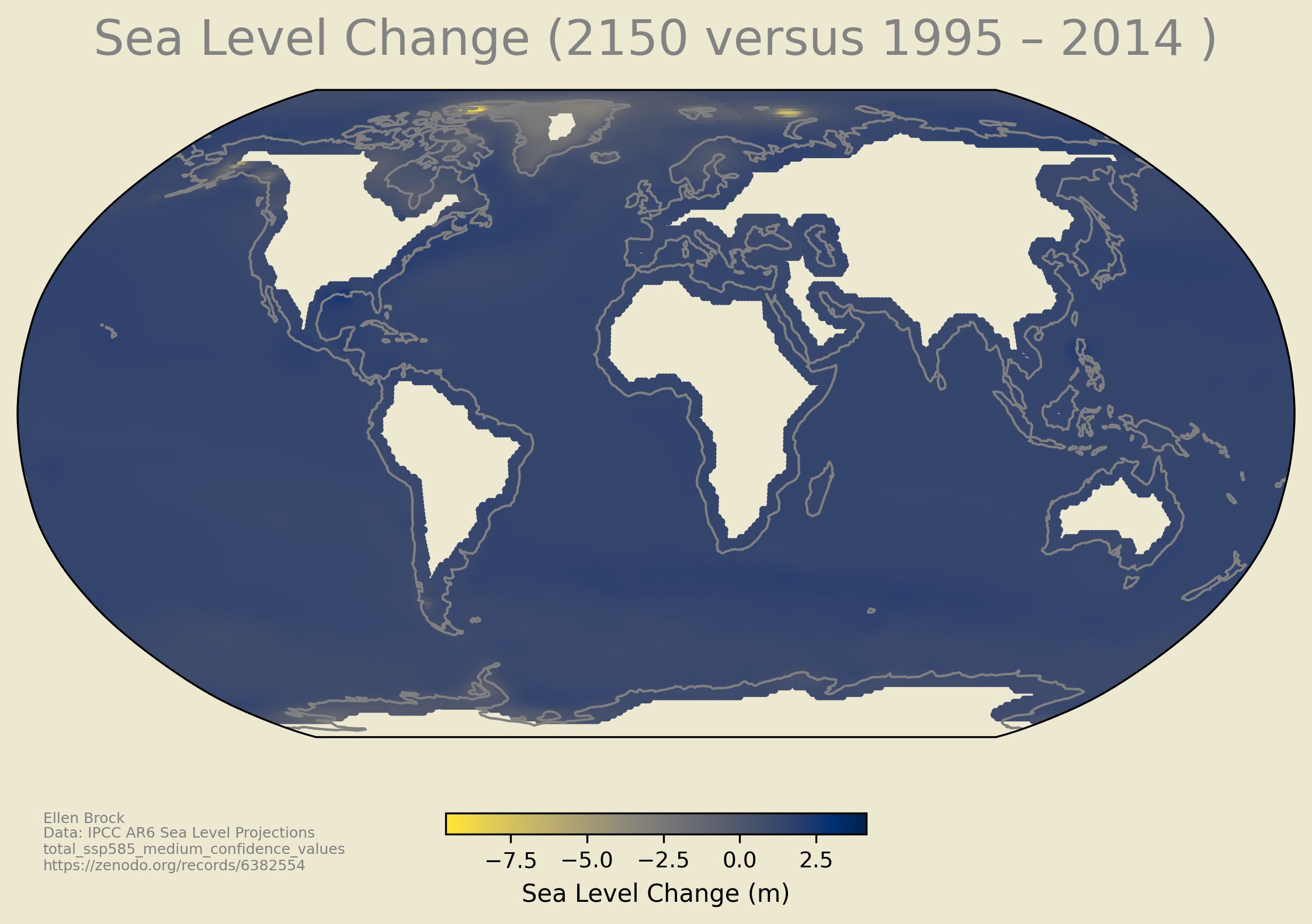
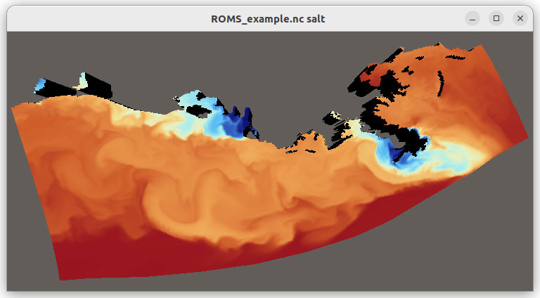
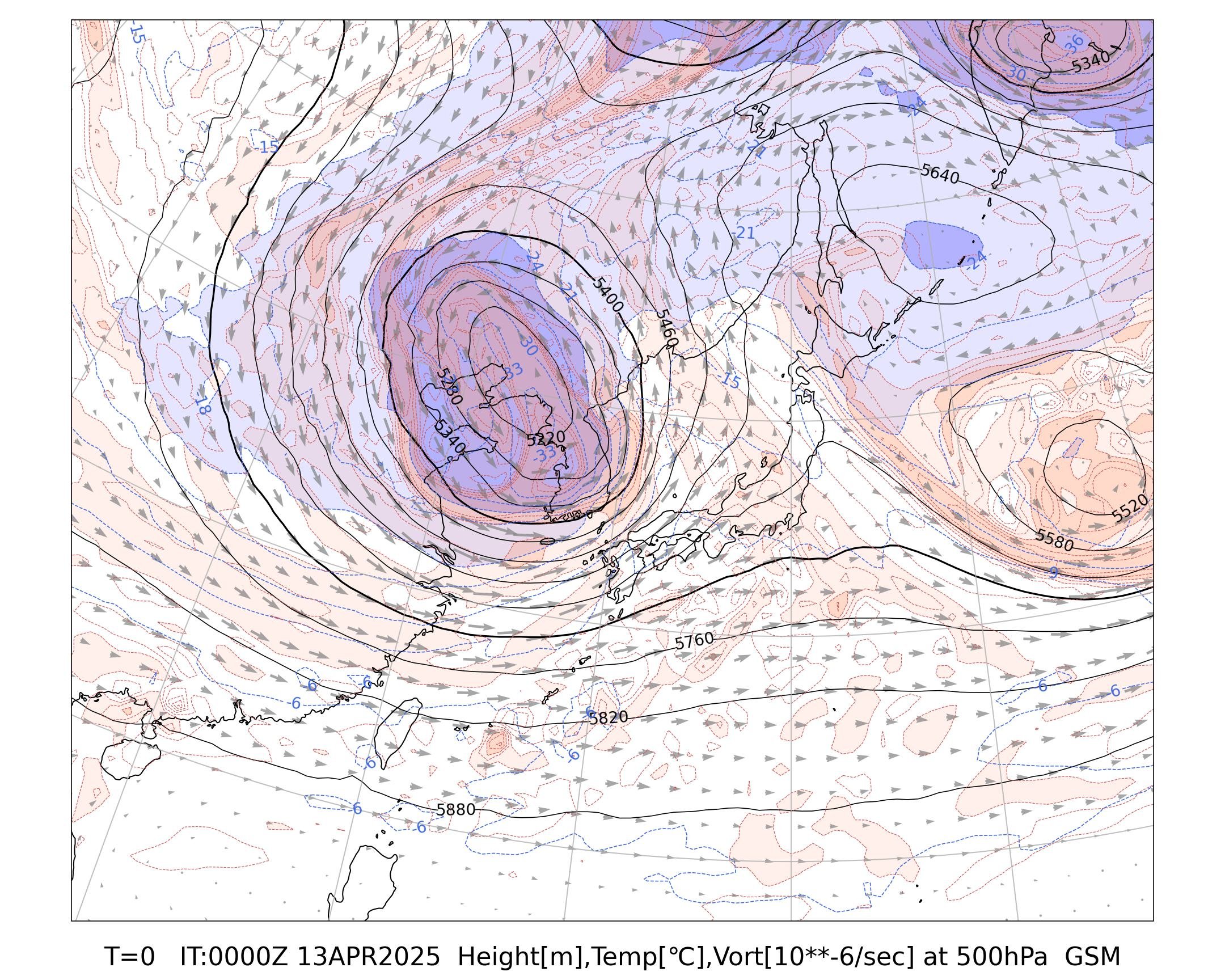
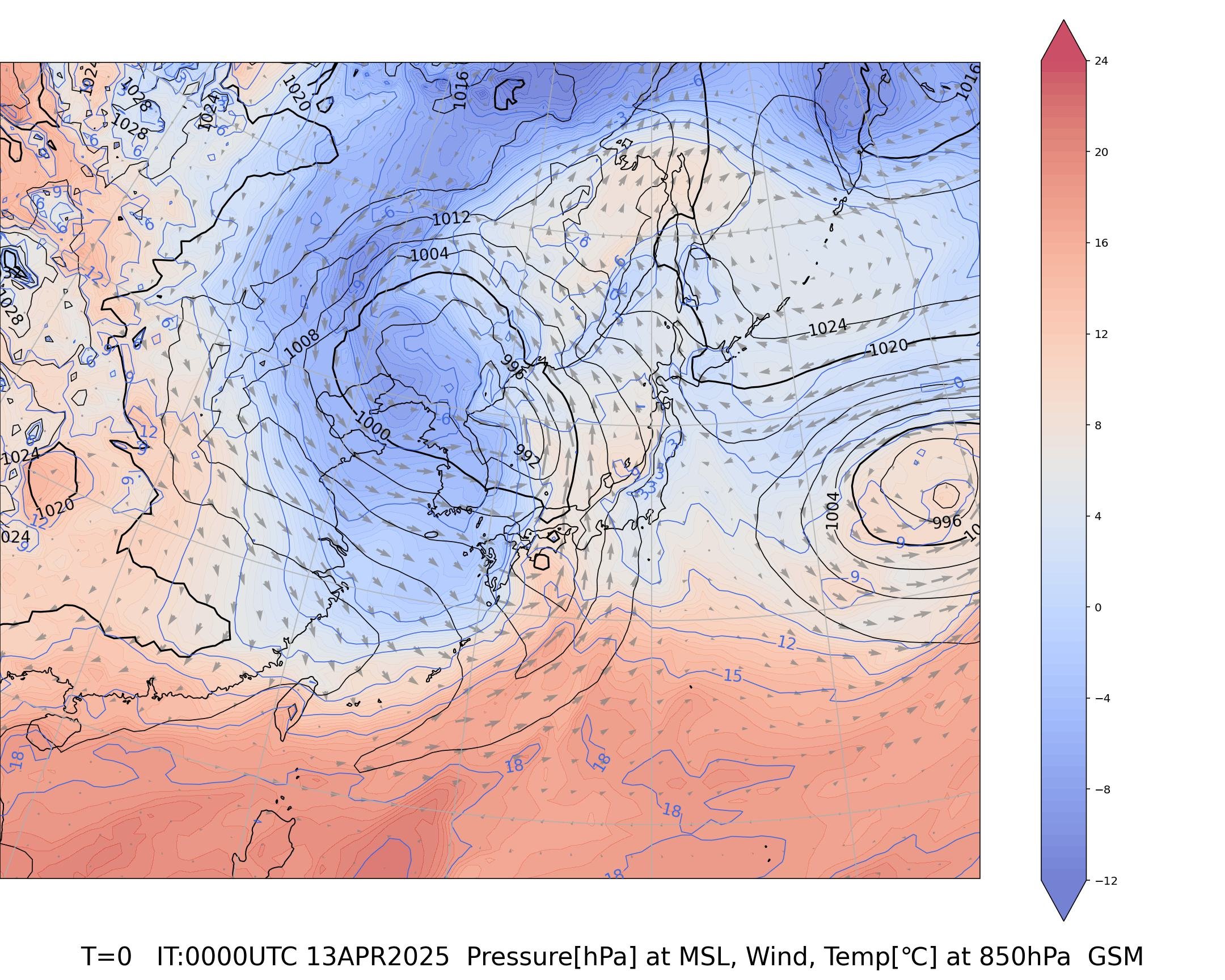
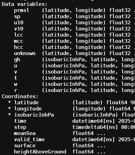
We’ve enabled direct visualization of #Xarray datasets in #VTK and #ParaView, with native support for labeled dimensions, Dask-backed arrays, and lazy-loading I/O. No more conversions—just drop your data in and start exploring it in 3D! Read more: ow.ly/AIt050W57ph
201
sho/JS2KIP
sho/JS2KIP @shotash11 ·
4/13(日) AM9:00の解析データ ・1枚目:上空500hPaの高度と気温 ・2枚目:地上の気圧と850hPa(高度約1500m)の気温 朝鮮半島上空の寒冷渦と、西日本から沖縄付近にのびる前線が見えます JRA-3Qデータ用に作ったPythonのコードをGSM用に手直したので試し描き #Python #Metpy #xarray
1
217
Joachim Schork
Joachim Schork @JoachimSchork ·
Exciting news for the geospatial community! A new dedicated platform is now available for open-source geospatial Python tutorials, featuring #GeoPandas, #XArray, #Dask, and more. A great resource for anyone working with geospatial data. Thank you, @spatialthoughts, for making these valuable tutorials accessible! #Geospatial #Python #DataScience #OpenSource
Ujaval Gandhi Ujaval Gandhi @spatialthoughts ·
Launching a new home for all our open-source geospatial python tutorials - covering #GeoPandas, #XArray, #Dask, #XEE, #SamGeo and more. Check them out at geopythontutorials.com
1
1.4K