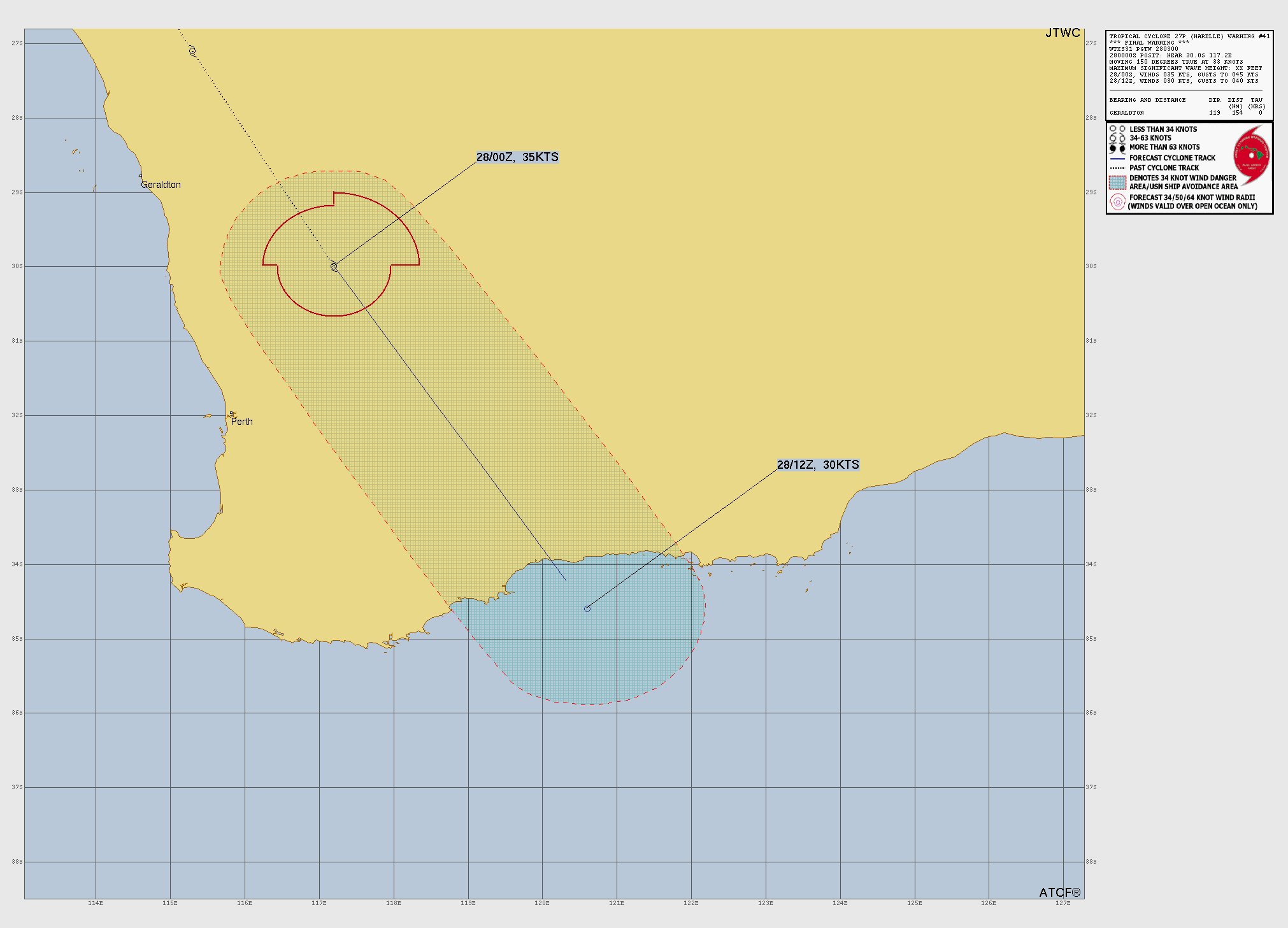
Powerful Cyclone #Narelle now extratropical or post tropical was a very long lived and significant cyclone that brought moderate to heavy to very heavy rainfall/gusty to damaging winds/storm surge to parts of Queensland/Northern Territory/Western Australia #wxtwitter#tropicswx#cyclone#tropicalupdate#rainfall#severewx#BREAKING
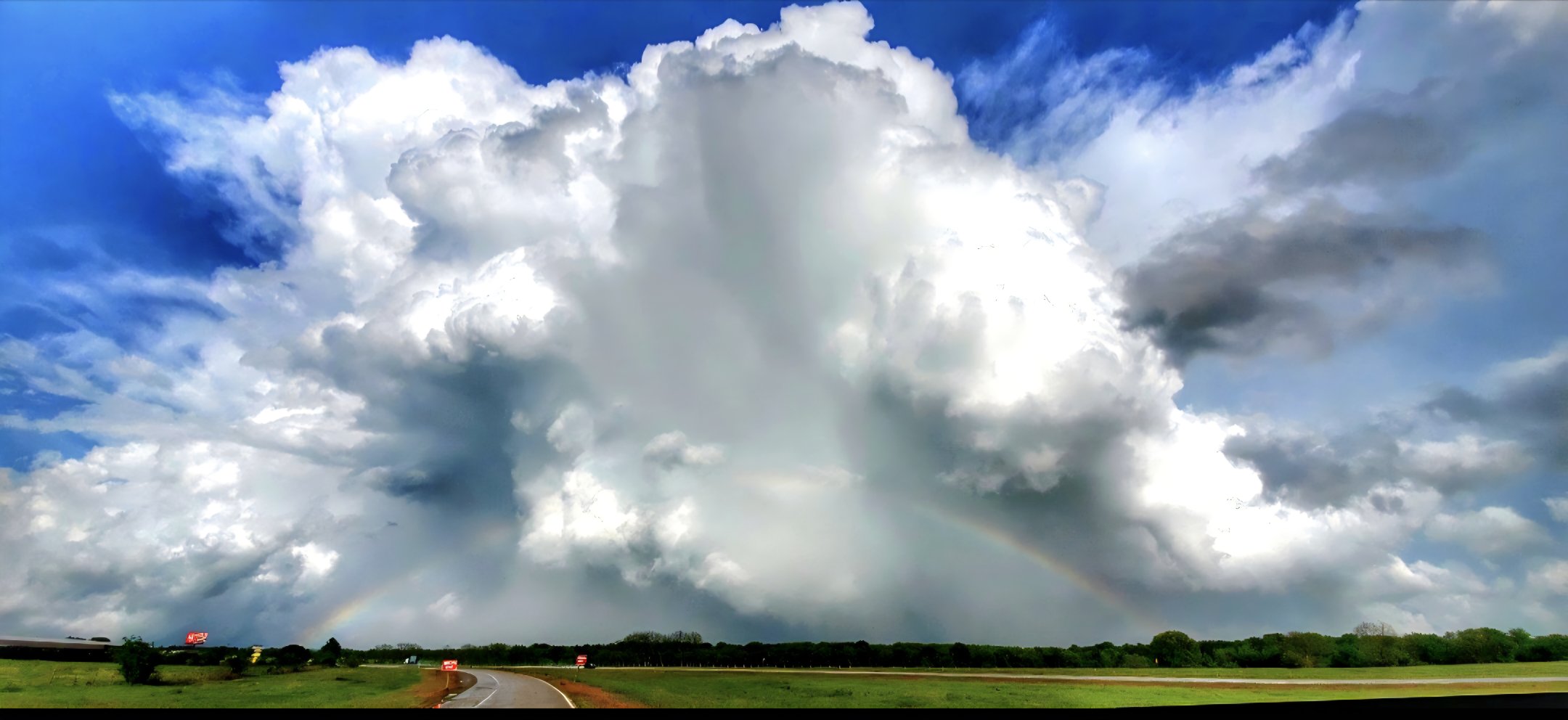
The weather has been quiet today and will continue to be through the overnight hours except for some isolated to scattered rain showers associated with a cold front produce light rainfall making travel difficult at times so please be careful out there #wxtwitter#rainfall
The tropical weather forecast for the entire Indian Ocean into late next week according to the 00z US GFS model is showing a cyclone developing and remaining out to sea not impacting anyone or anything which is good news #wxtwitter#tropicalupdate#tropicswx#cyclones#BREAKING
The 00z US GFS model into late next week is still showing a powerful cyclone developing and moving southwestward in the direction of some Islands and producing moderate to heavy rainfall and gusty to damaging winds #wxtwitter#tropicswx#tropicalupdate#cyclones#BREAKING
Now post tropical cyclone or extratropical cyclone #Narelle but was a powerful cyclone impacted Western Australia with moderate to heavy to very heavy rainfall/gusty winds/storm surge since yesterday but thankfully its weakening now #wxtwitter#tropicswx#cyclone#tropicalupdate
The newest GFS model run (00z) during the next week is showing a strong tropical storm or typhoon developing sometime next week and moving west slowly and not impacting anyone but other than that it's a quiet basin #wxtwitter#tropicswx#tropicalupdate#typhoon#BREAKING
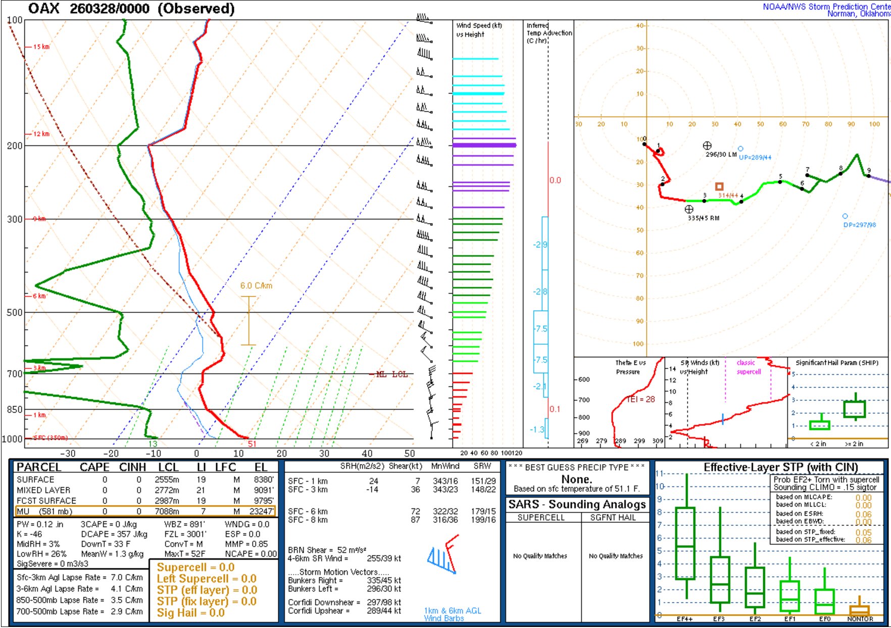
Tornadoes I ✅
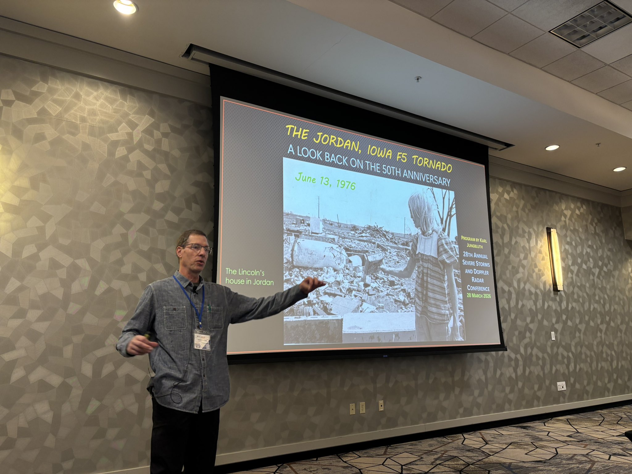
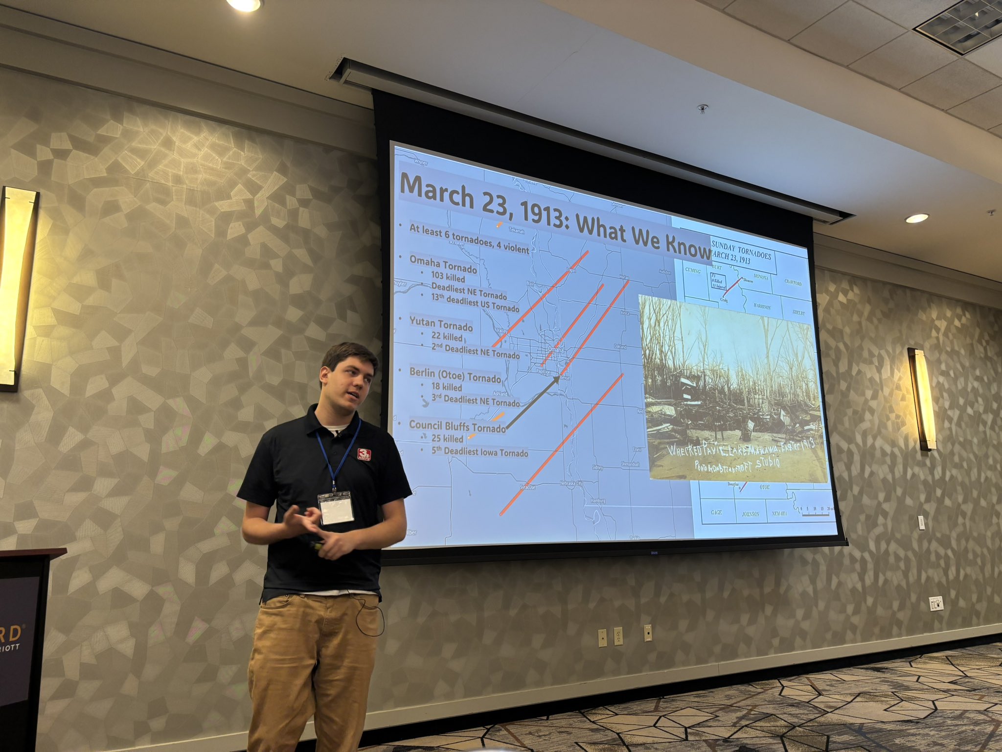
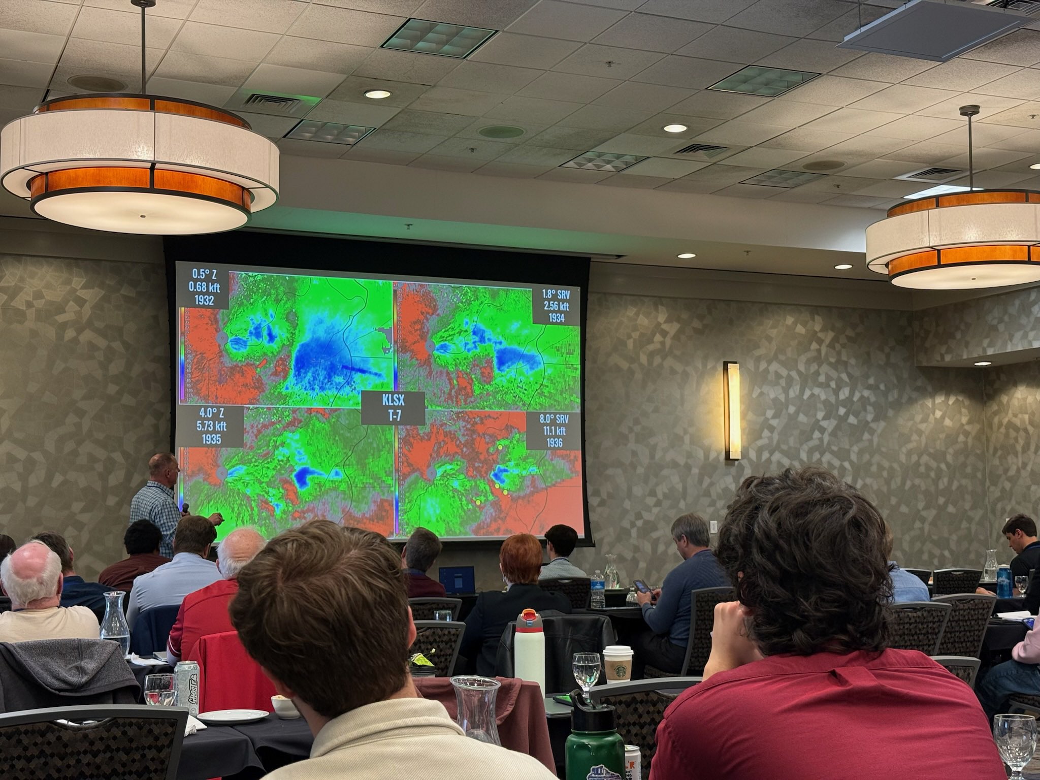
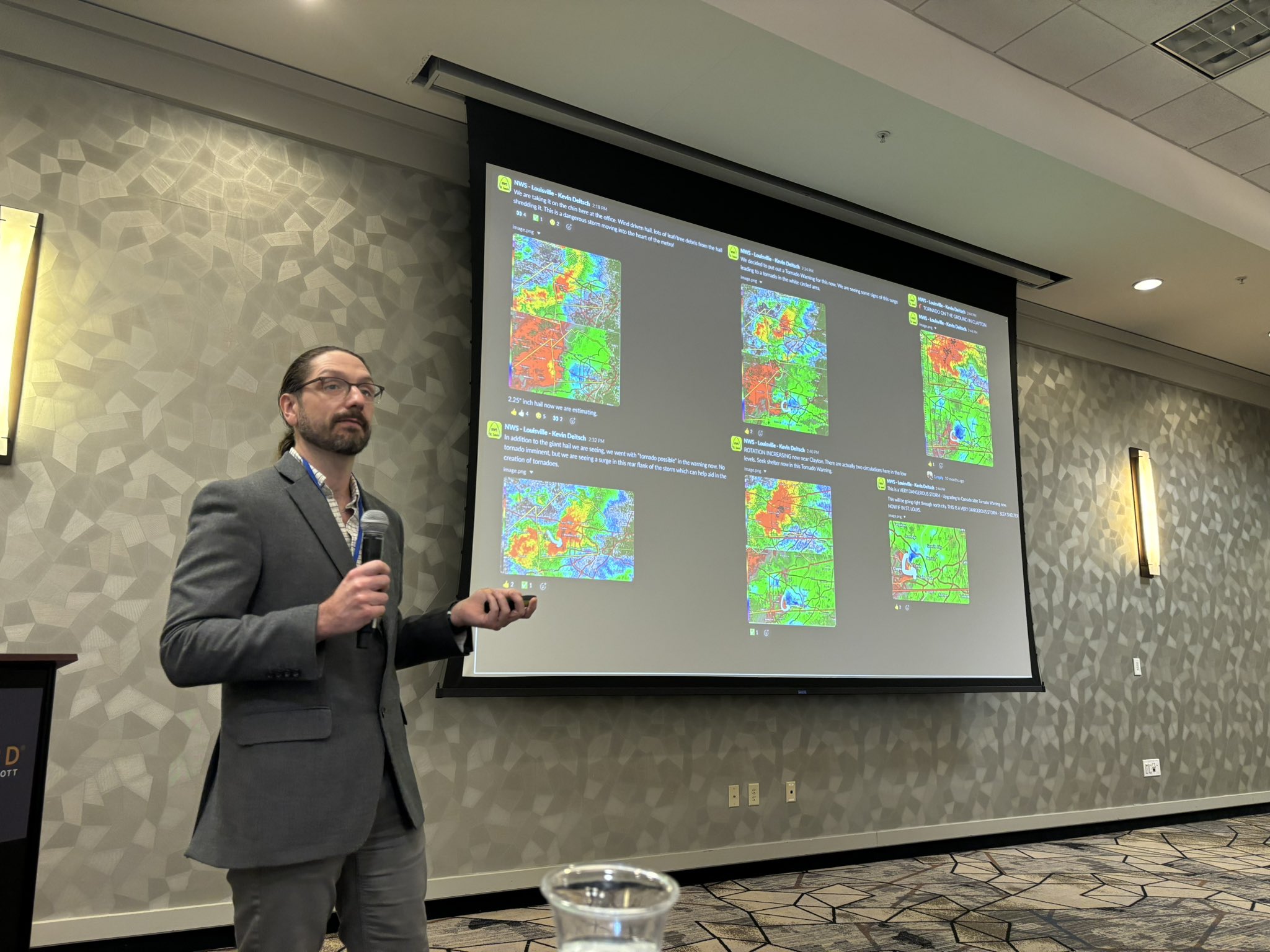
Thank you so much to Karl Jungbluth, Joesph Meyer, Fred Glass, Ben Herzog, and Alex Elmore for presenting on historic tornado events!
#wxtwitter
Very quiet and warm weather is forecast to continue into Monday morning across the lower 48 states according to the 00z nam3k model run except for some isolated to scattered areas of rain and snow showers at times #wxtwitter#rainfall#snowfall#firewx
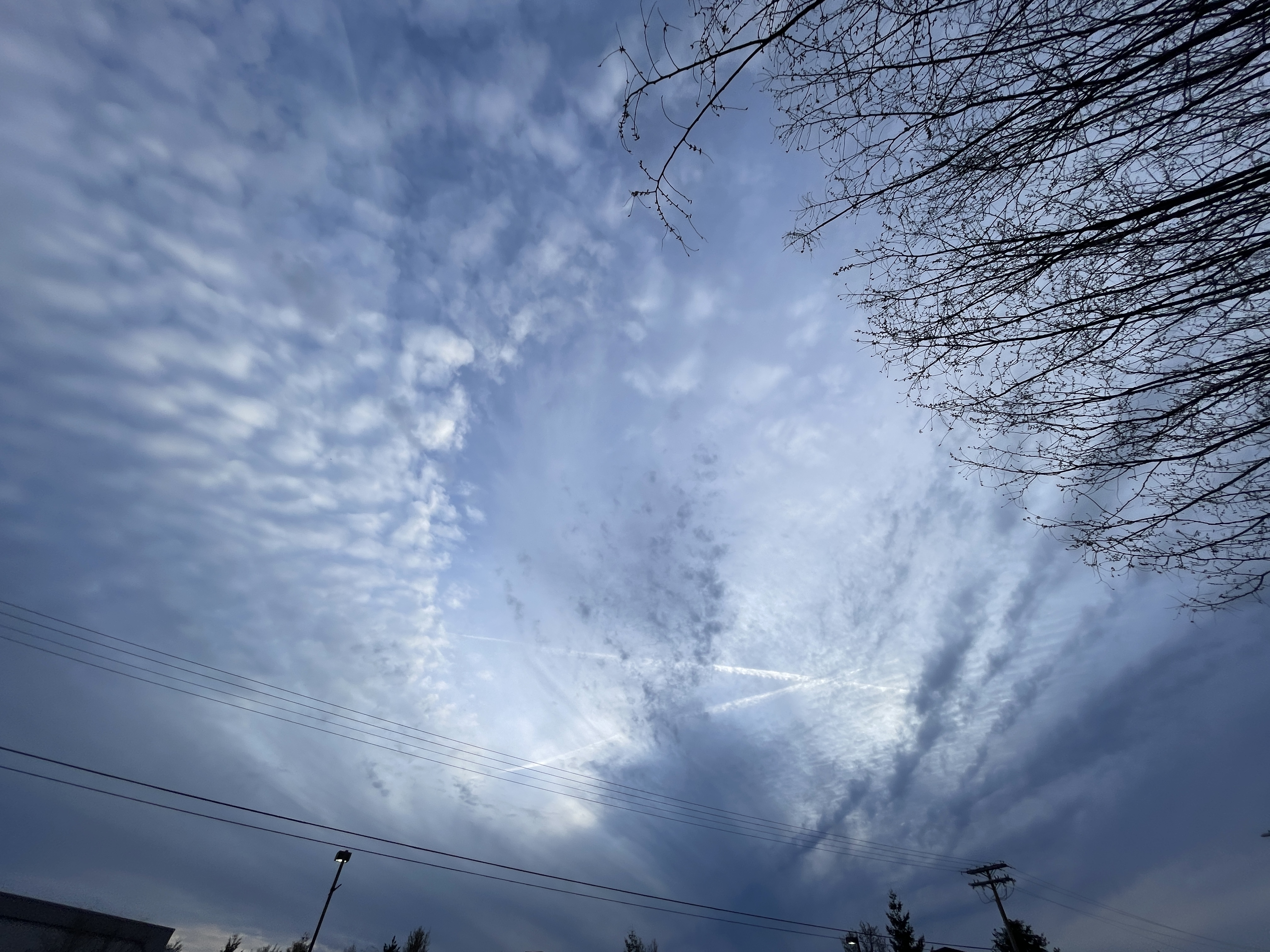
The strong cold front is still moving southeastward across the southeast and Mid-Atlantic producing scattered to isolated showers that are producing light rainfall making travel difficult at times through tonight #wxtwitter#rainfall
Here is the 7-day outlook in the tropics in the Indian Ocean according to the 18z US GFS model run and it is continuing to show a quiet basin except for a cyclone developing but staying out to sea and not impacting anyone #wxtwitter#tropicalupdate#tropicswx#cyclones
This is the outlook in the southwestern Pacific Ocean into late next week according to the 18z US GFS model run and it is still showing another strong cyclone developing and moving in the direction of Australia #wxtwitter#cyclones#tropicalupdate#tropicswx#BREAKING
Here is the outlook into next Friday in the western Pacific Ocean according to the 18z US GFS model and it is still continuing to show a tropical storm or typhoon developing so we will see if it does develop #wxtwitter#tropicswx#tropicalupdate#typhoon#tropicalstorm