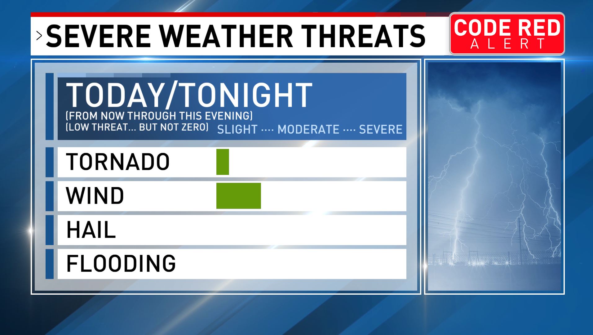
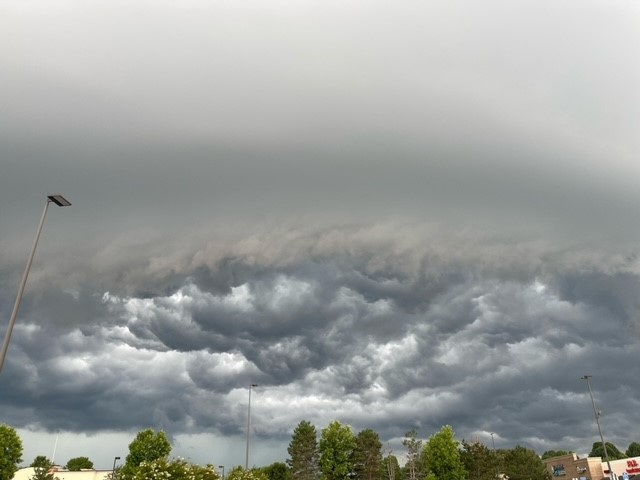
#CodeRedWeather A cold front may cause strong to severe storms with damaging winds 🌬️ this evening. The tornado risk is currently very low, and cooler weather is expected to arrive by Friday 🌡️bit.ly/48MhgCHaso
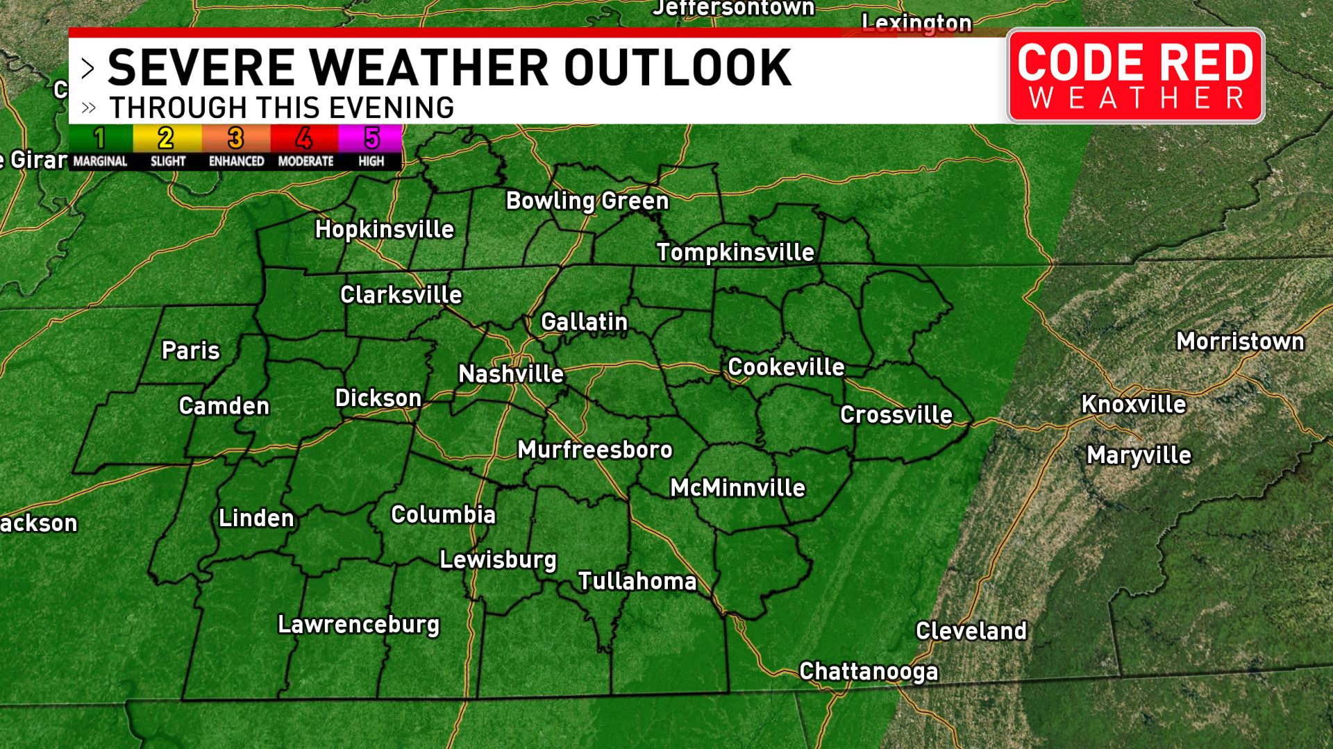
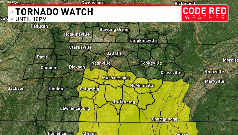
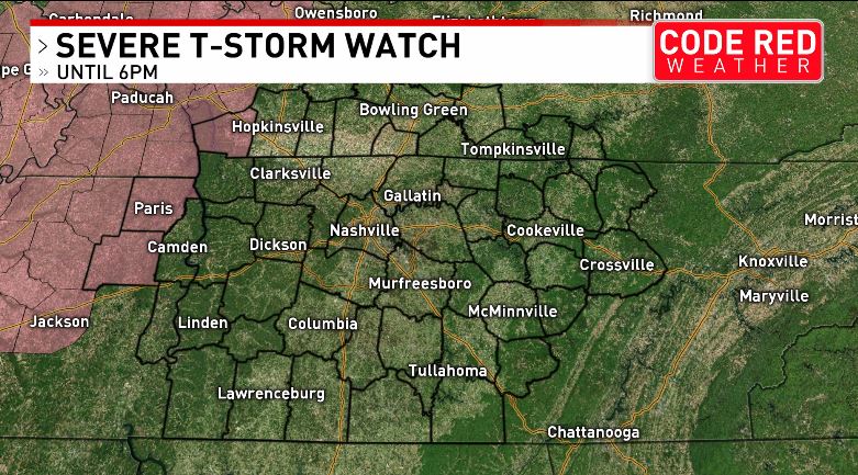
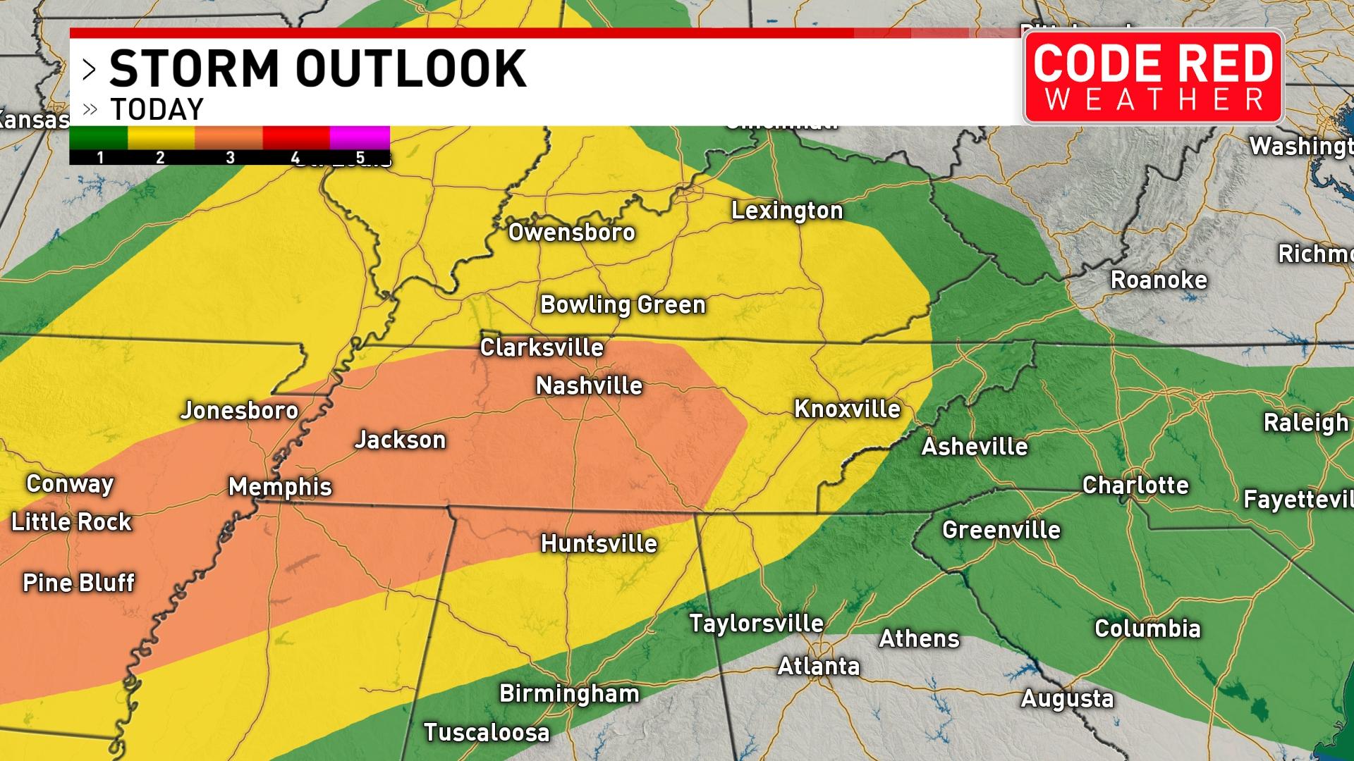
TORNADO RISK MAP: All modes of severe weather are possible this afternoon & evening, including a few tornadoes. Here's the latest look at our tornado risk and Code Red Weather Alert: bit.ly/3j8Jehz#CodeRedWeather
Since communication during severe weather events are important, please be sure to sign up for our Code Red Weather Warnings here: bit.ly/Code_Red_Augus…
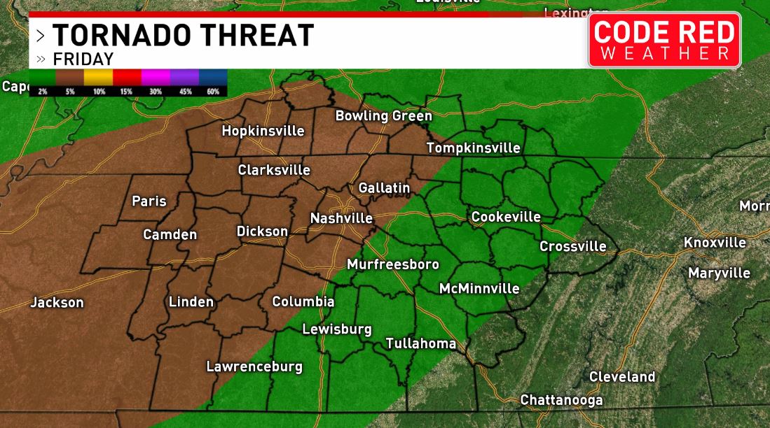
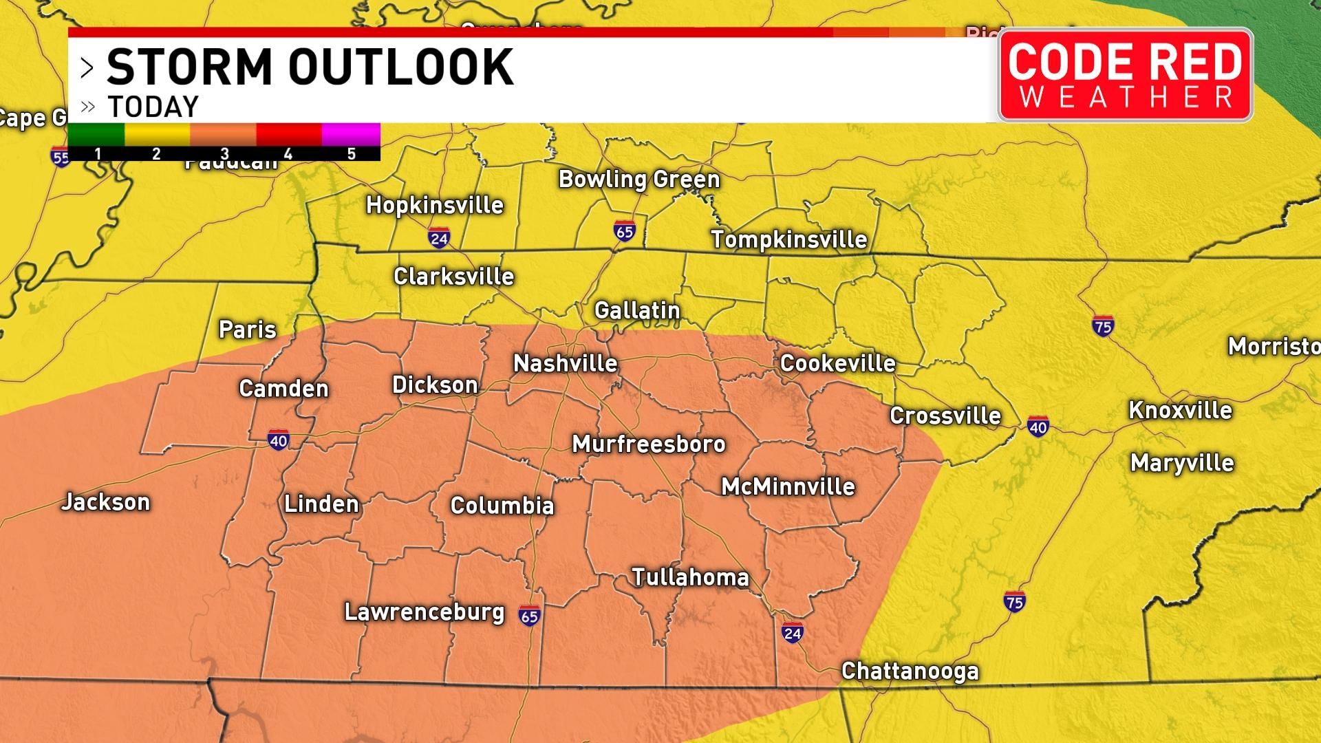
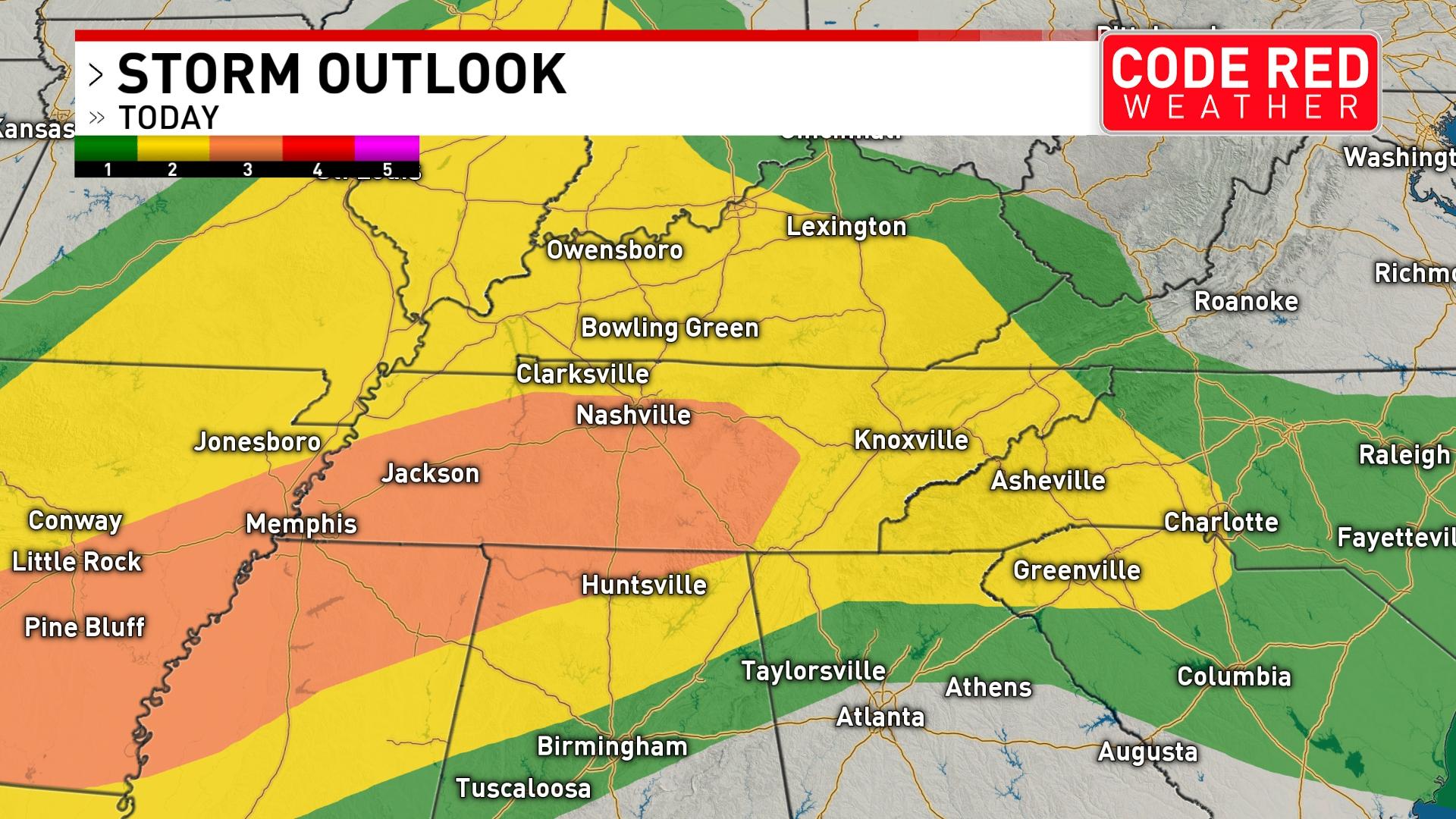
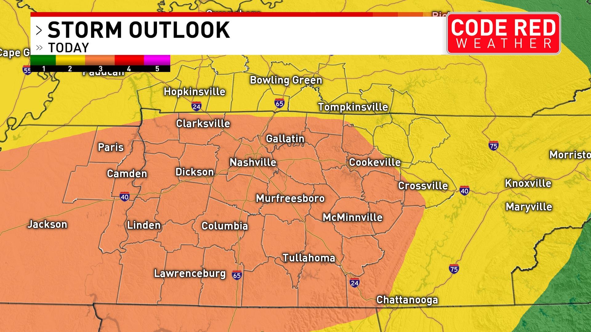
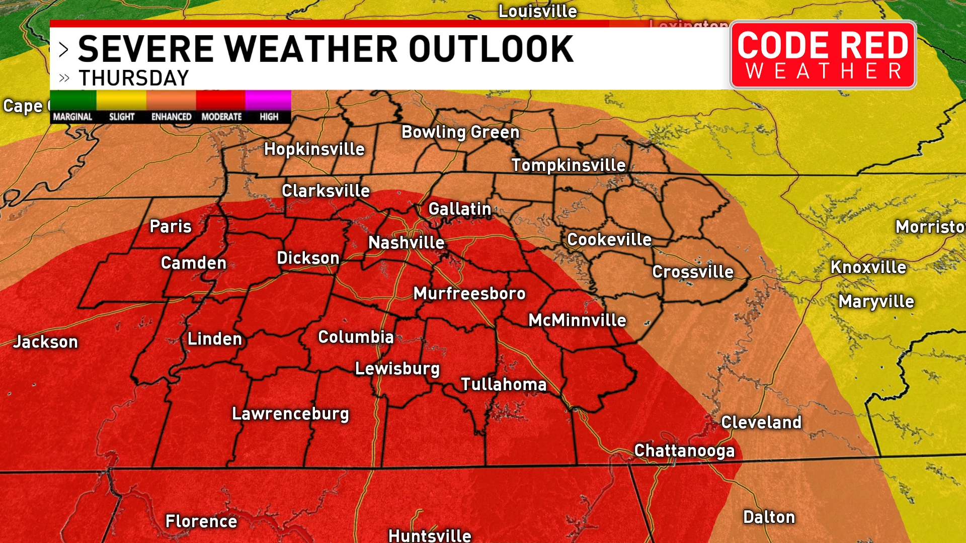
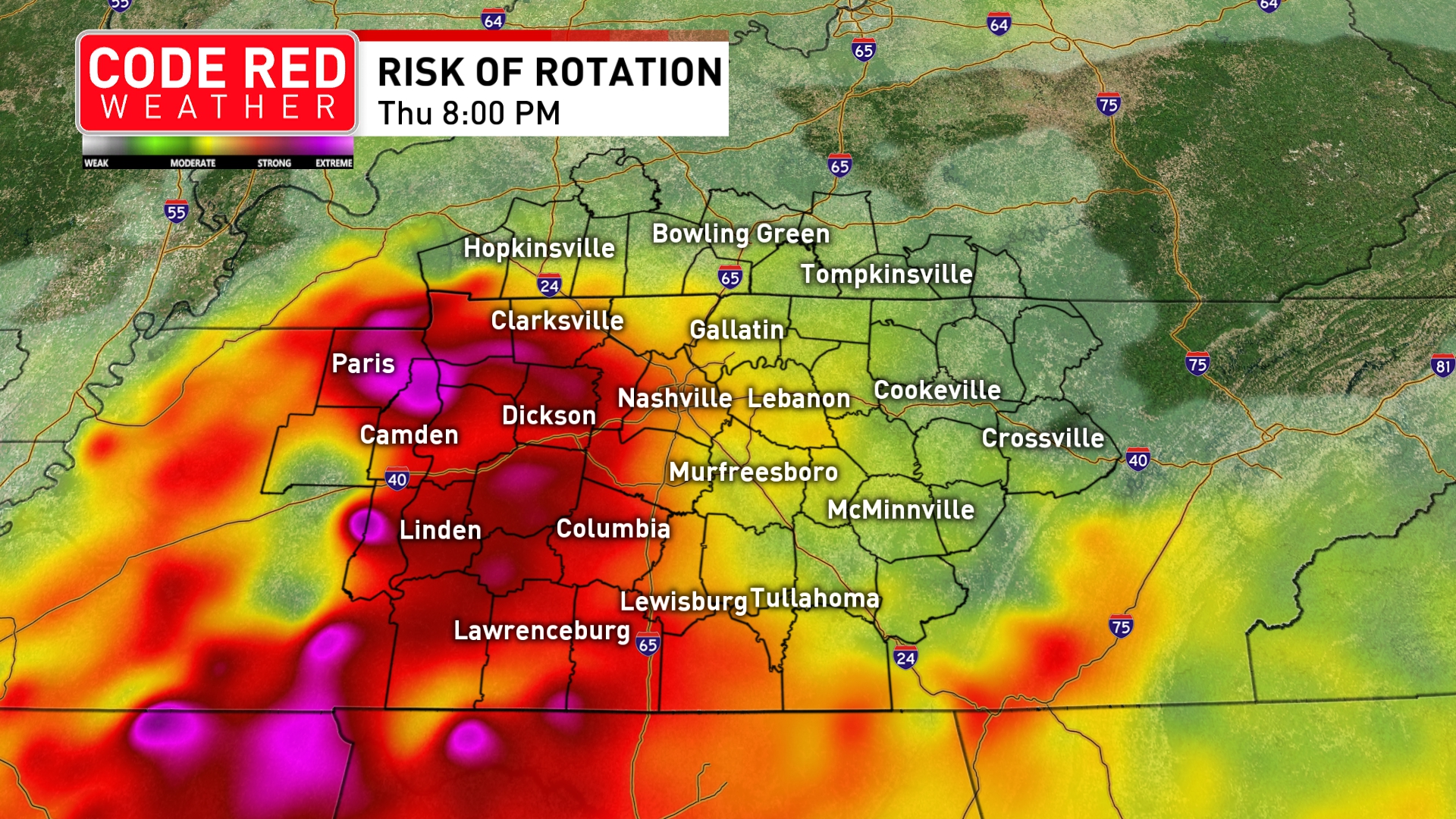
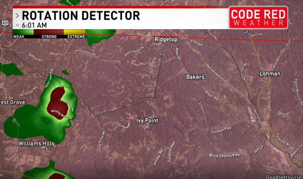
SEVERE WEATHER THREAT INCREASED ⚠️ More Middle Tennessee counties are under an "ENHANCED" risk for severe weather, or a 3 out of 5. This is truly an overnight event that could produce spin-up tornadoes: bit.ly/3supbgj#CodeRedWeather
SEVERE WEATHER THREAT INCREASED ⚠️ More Middle Tennessee counties are under an "ENHANCED" risk for severe weather, or a 3 out of 5. This is truly an overnight event that could produce spin-up tornadoes: bit.ly/3supbgj#CodeRedWeather
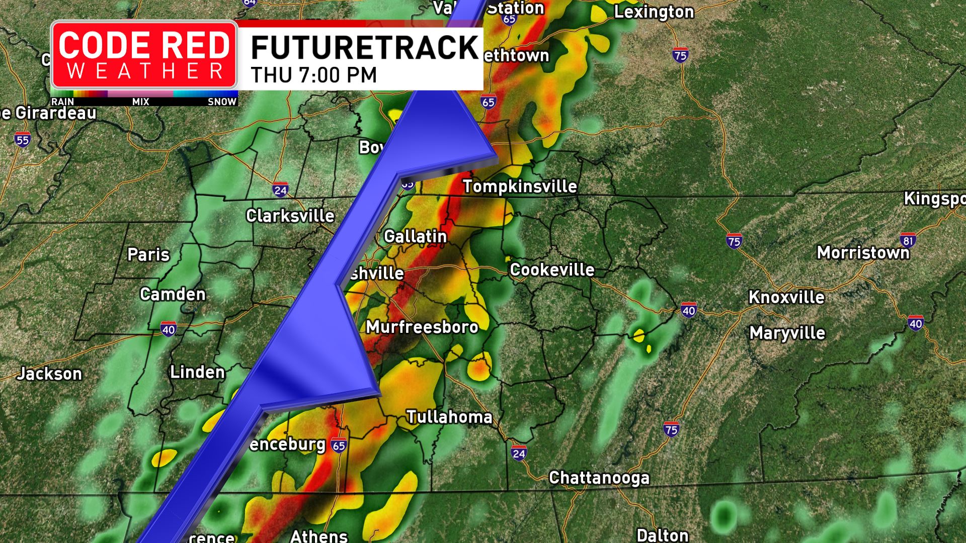
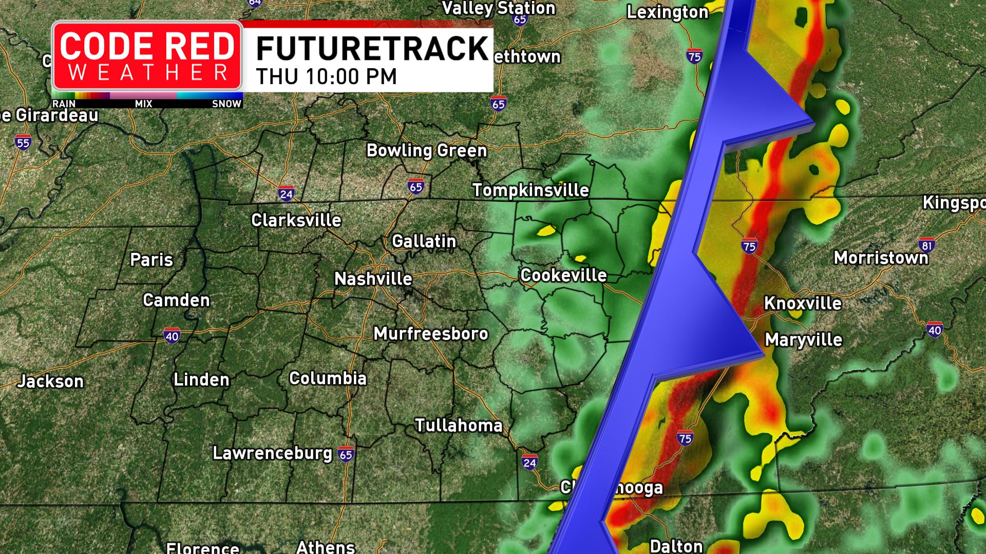
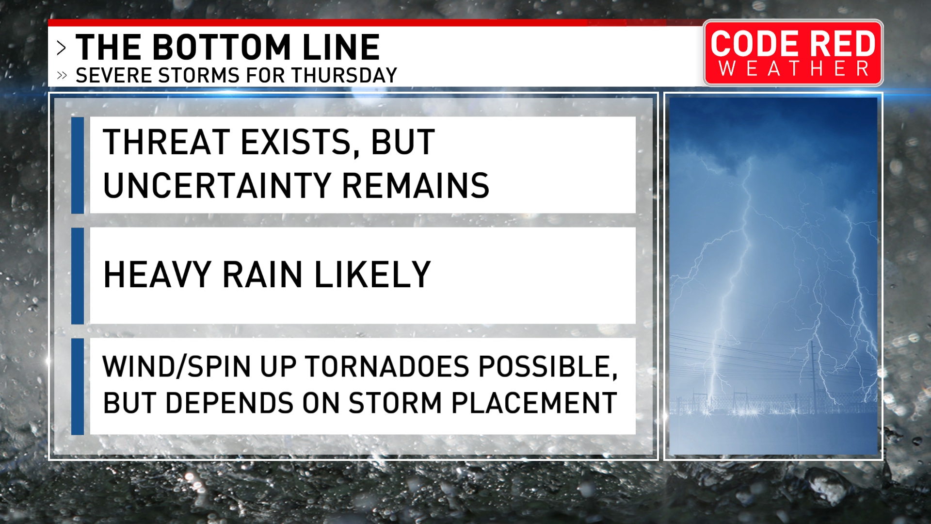
Key takeaways for #CodeRedWeather on Thursday:
✅ These will be fast-moving, rapidly-changing storms
✅ Avoid travel if possible during late day/evening
✅ Shelter in place when warning is issued. Don't wait
✅ Make sure mobile devices are fully charged
bit.ly/3tRE3pk
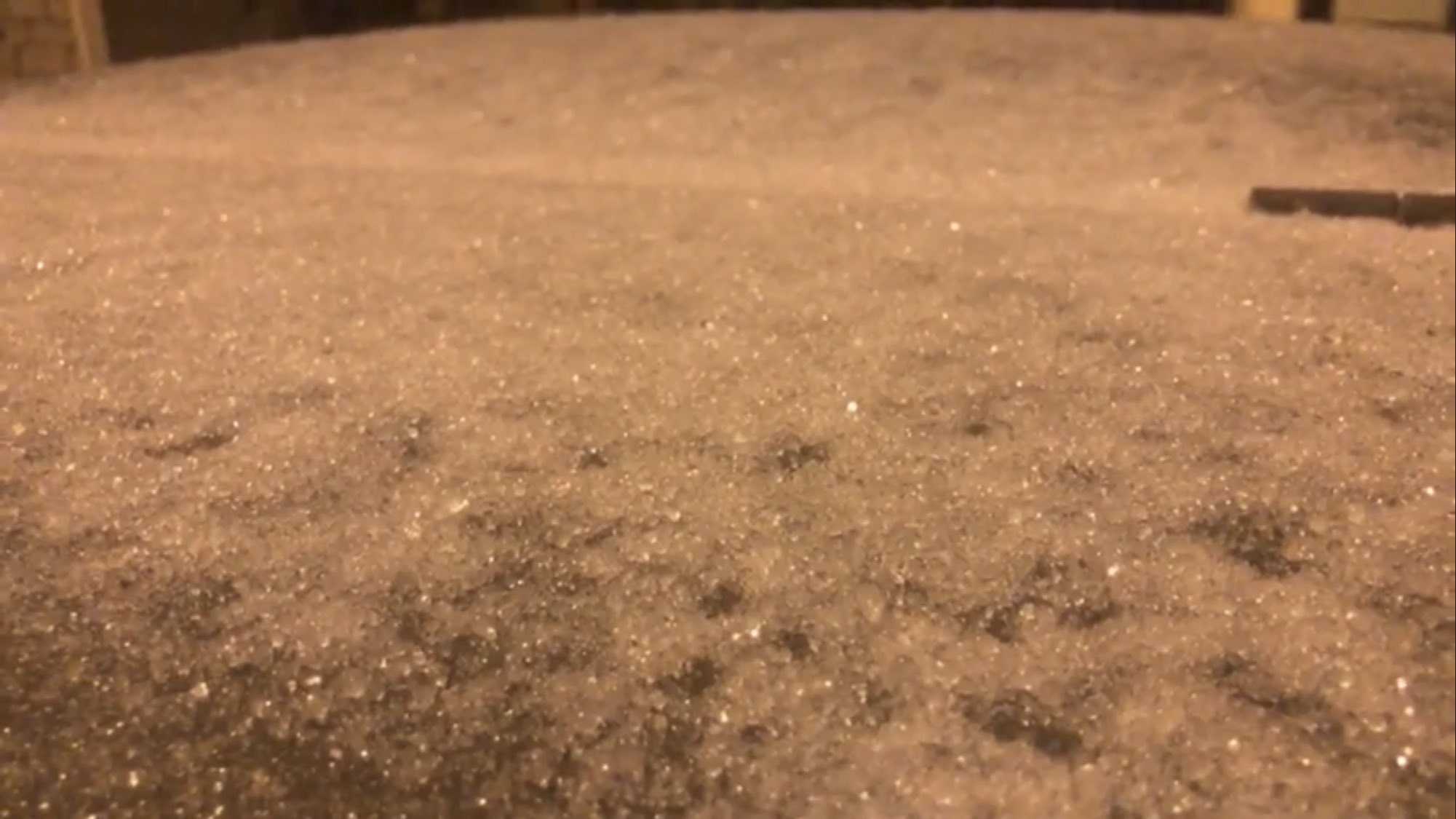
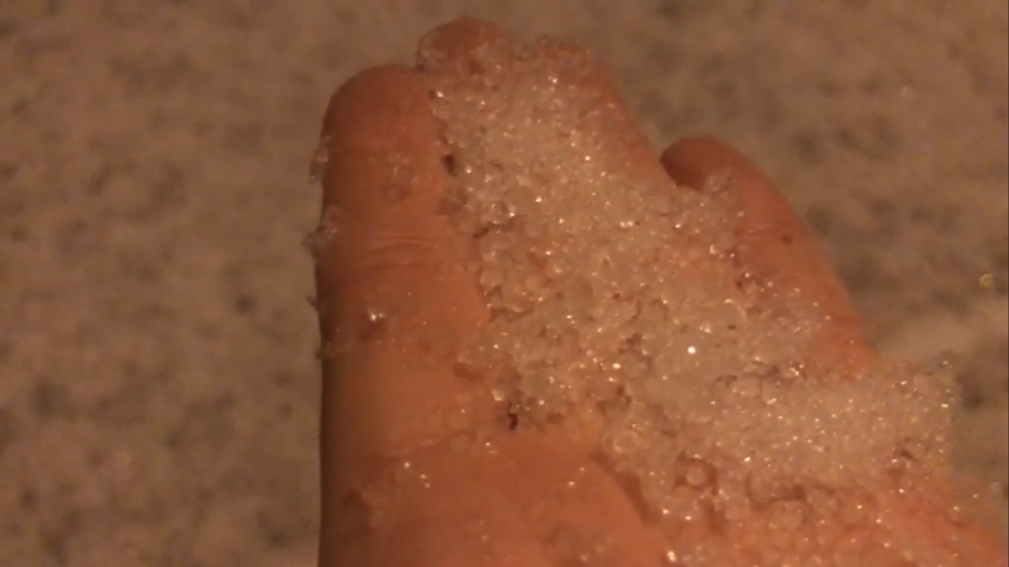
LIVE: Folks are waking up to ice & snow covered streets. Road travel is NOT advised. We've got team coverage from conditions across the midstate. fox17.com/watch#CodeRedWeather
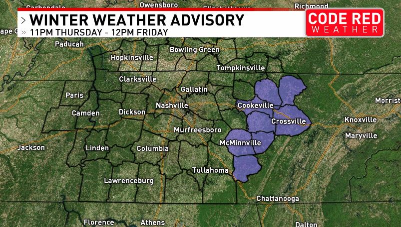
JUST IN: Winter Weather Advisory issued for some counties that could see 1-2" of snow Friday, with isolated pockets up to 3” #CodeRedWeatherbit.ly/35k576H